
pricing options
-
Description text goes here
-
Description text goes here
-
Description text goes here

-
Description text goes here
-
Description text goes here
-
Description text goes here

-
Description text goes here
-
Description text goes here
-
Description text goes here

-
Description text goes here
-
Description text goes here
-
Description text goes here
-
Description text goes here
-
Description text goes here
-
Description text goes here
-
Description text goes here
-
Description text goes here
-
Description text goes here
-
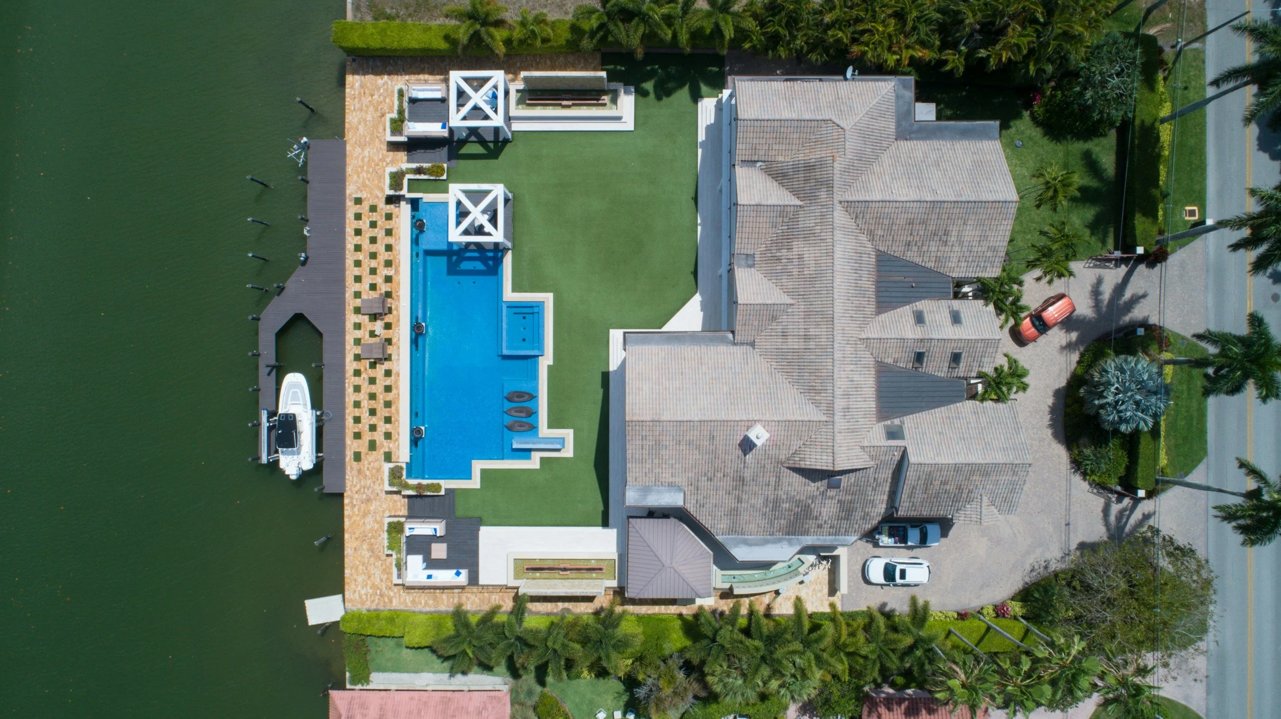
REAL ESTATE
Drone real estate photography offers high-quality aerial images and videos that showcase properties from unique angles. This service is designed to enhance real estate listings, providing prospective buyers with a comprehensive view of the property and its surroundings.
Basic Package
(10-15 photos, 1-2 minutes of video): $150 - $300
Standard Package
(20-30 photos, 3-5 minutes of video): $300 - $500
Premium Package
(30-50 photos, 5-10 minutes of video, 360-degree virtual tour): $500 - $800
Included Services:
• Aerial photography and videography of the property
• High-resolution images (10-50 photos depending on the package)
• Short promotional video clips (1-10 minutes)
• 360-degree panoramic shots (for premium packages)
• Post-processing and editing of images and videos
• Integration with real estate platforms and virtual tours
-

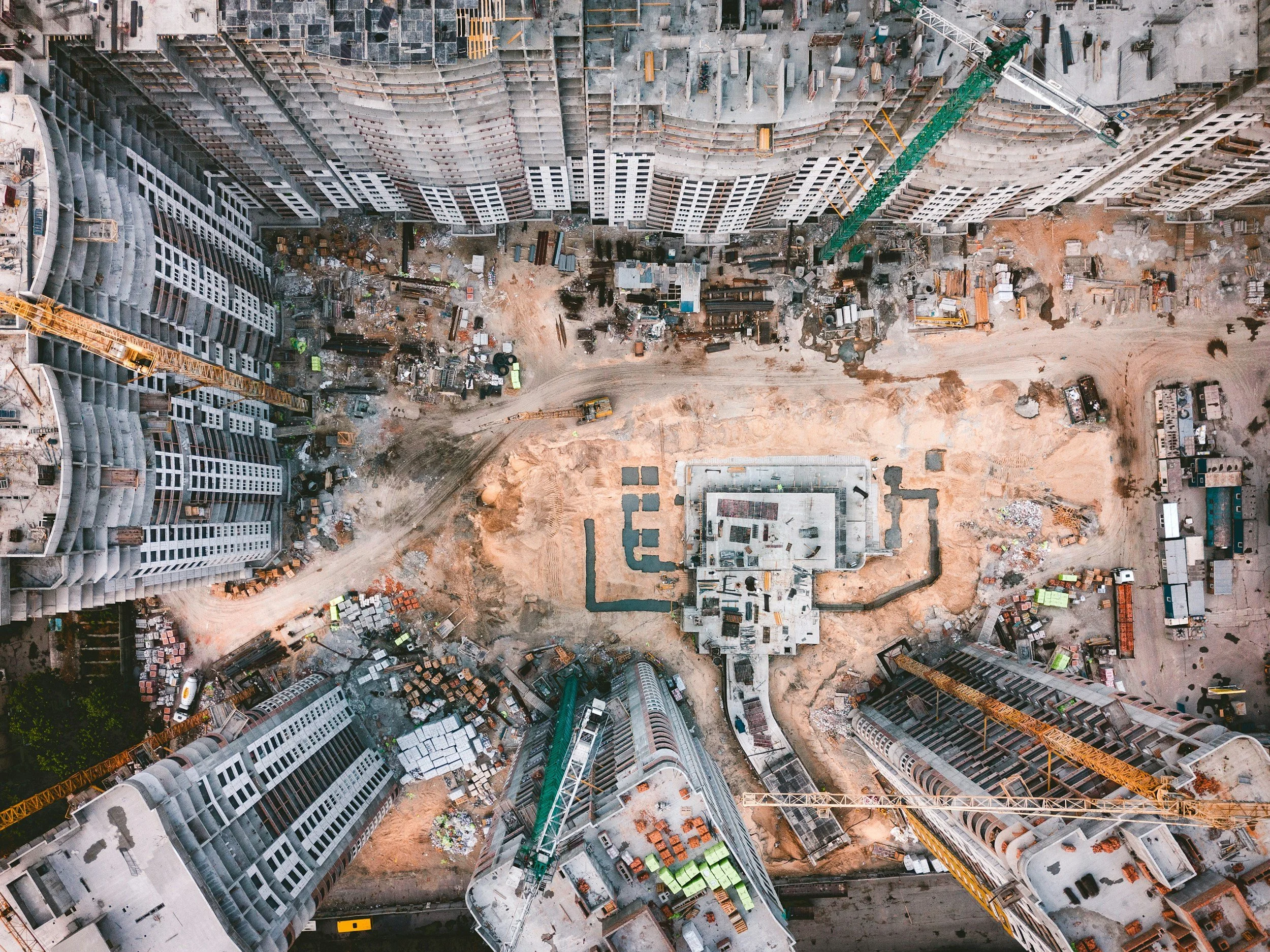
CONSTRUCTION
Drone services for construction sites provide essential aerial views for monitoring progress, ensuring safety, and enhancing project management. These services deliver precise data and visual documentation to support various stages of construction.
Site Monitoring
(weekly or bi-weekly visits, progress photos): $200 - $500 per visit
Detailed Mapping
(high-resolution maps, 3D models): $1,000 - $3,000 per project
Stockpile Analysis
(volumetric analysis for earthworks and stockpiles) $500 - $1,500 per session
Included Services:
• Regular site monitoring and progress reporting (weekly or bi-weekly)
• High-resolution aerial images and video documentation
• 3D mapping and modeling of construction sites
• Stockpile analysis for more accurate identification of onsite materials
• Volume calculations for materials and earthworks
• Compliance documentation and safety inspections
-

INSPECTION
Drone infrastructure inspection services provide detailed and efficient inspections of critical infrastructure, including bridges, towers, and buildings. These services help identify issues early and reduce the need for dangerous manual inspections.
Standard Inspection
(bridges, towers, buildings): $300 - $1,000 per structure
Detailed Inspection
(high-resolution photos, video, thermal imaging): $1,000 - $3,000 per structure
Comprehensive Inspection
(including detailed reports, multiple visits): $3,000 - $7,000 per structure
Included Services:
• High-resolution aerial inspections
• Detailed imaging and video capture of structures
• Thermal imaging to detect heat anomalies and structural issues
• Comprehensive inspection reports with annotated images
• Scheduled inspections for ongoing maintenance
• Emergency inspection services after natural disasters
-
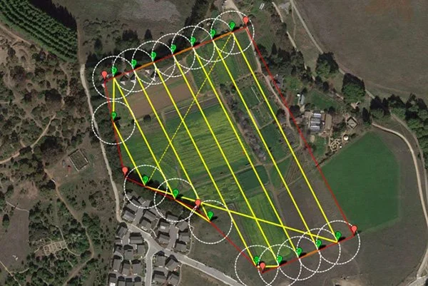
MAPPING
Drone mapping services create detailed and accurate maps of geographical areas, providing valuable data for various industries. These services include the collection and processing of aerial data to generate 2D and 3D maps.
Basic Mapping
(2D maps for small areas): $500 - $1,500
Advanced Mapping
(3D models, larger areas): $1,500 - $5,000
Specialized Mapping
(topographic maps, volumetric calculations): $2,000 - $6,000
Included Services:
• Aerial surveying and data collection
• High-resolution 2D orthomosaic maps
• 3D terrain and surface modeling
• Topographic maps and contour line generation
• Volumetric analysis for earthworks and stockpiles
• Post-processing and data analysis
-
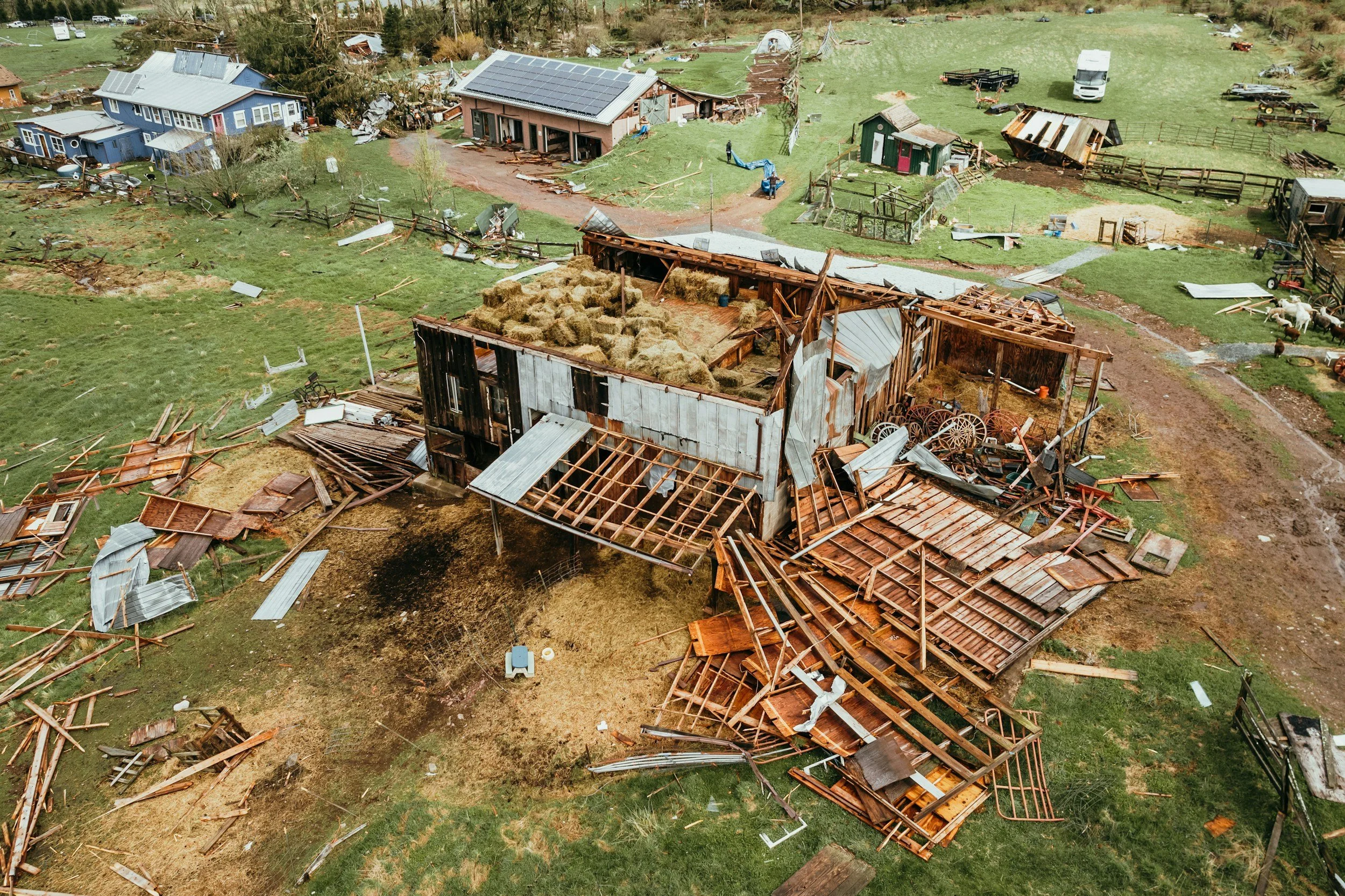
INSURANCE
Drone insurance services offer precise and rapid assessment of properties and assets for insurance claims. These services facilitate accurate damage assessments, reducing the time and cost associated with traditional inspection methods.
Basic Property Assessment
(photos and video for claim documentation): $200 - $600
Detailed Damage Assessment
(high-resolution imaging, thermal imaging): $600 - $2,000
Catastrophic Event Assessment
(large-scale surveys, multiple properties): $2,000 - $10,000 depending on the scope
Included Services:
• Pre-loss property documentation
• Post-loss damage assessment with high-resolution imagery
• Thermal imaging for detecting hidden damages
• Comprehensive assessment reports for claims processing
• Large-scale surveys for catastrophic events
• Coordination with insurance adjusters and agents
-

CUSTOM PROJECT
At Emerald Coast Aerial Experts, we understand that every project is unique and may require tailored solutions beyond our standard service offerings. Our custom drone project services are designed to meet your specific needs and objectives, no matter how specialized or complex they may be. Whether you have a unique vision or a challenging requirement, our experienced team is here to work with you to develop a customized solution that fits your project perfectly.
_______________________
Reach out to us today for a custom quote and/or consultation of your project needs!
_______________________
No project is too big or too small for us!